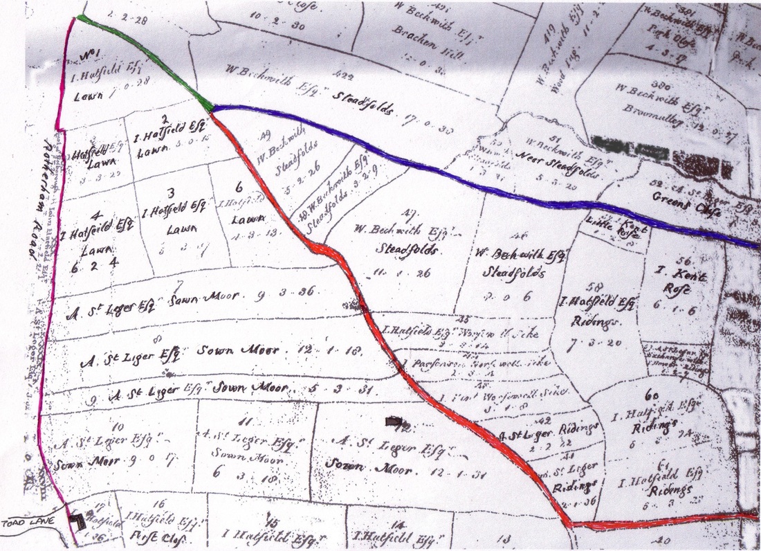
The Map below is part of a larger map very kindly donated by Mr Barrie Sanders, it shows some of the land that is now Thurcroft.
The Green Line is Sandy Lane, Blue line is Steadfolds, Red line Is Laughton Road, and the thin purple line on the left is Green Arbour Road.
All the pieces of land have names and who owns them, where Katherine St, South St, West St, up to School Rd area was called The Lawns.
On the map where Green Arbour is to day was called Rotherham Rd, just on the map bottom left is Toad Lane
All the land to the west of Green Arbour,( Ivanhoe Estate, Katherine Street etc ) was in Brampton Lordship.
Green Arbour Farm is opposite Toad Lane. Sawn Moor Farm is the Black square in the field. no indication of Steadfolds Farm on map.
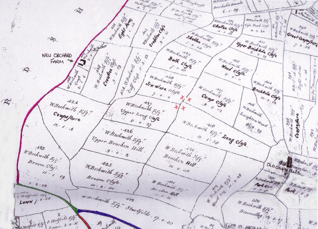
The map below is from the same one as above, this time the area shown is to the North of Sandy Lane, where the Pit was built.
Same as map above, Green line is Sandy Lane, Blue line is Steadfoulds Lane and Red Is Laughton Road.
The Purple line up the left hand side this time shows what would become New Orchard Lane (Pit Lane ) and on past New Orchard Farm.
All the land areas are named and who owns them, the three red crosses show the areas where approx the pit buildings would be, that
is Six acre Croft, Camp Croft, Upper Long Croft and part of Long Croft, New Orchard Farm is indicated on the map.
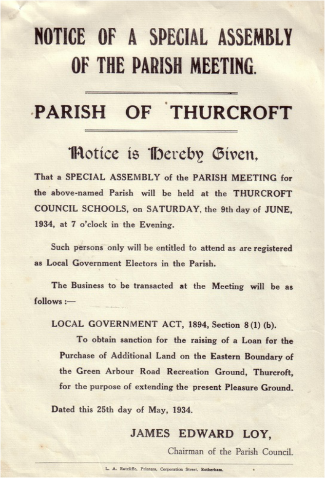
The Notice's, Plans, etc below were very kindly loaned to the web site by Mr Jeb Nightingale, from Thurcroft Parish Council records.
With thanks to Mr Harry Lockyer. for his help and assistance.
With thanks to Mr Harry Lockyer. for his help and assistance.
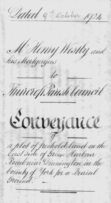
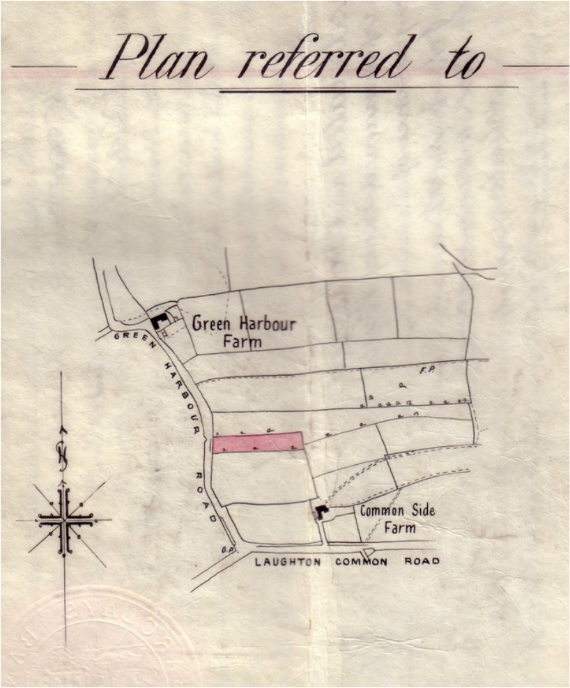
The document below refers to a piece of land that was sold by Mr Westby of Woodsetts, Innkeeper and Farmer, to Thurcroft Parish Council The land as can be seen from the plan was to be used as Thurcroft Cemetery, it cost £200 in 1924.
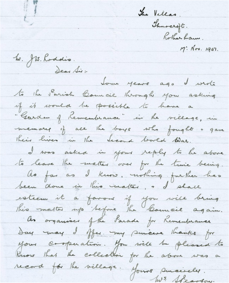
A short time after World War 2, a Mrs Pearson wrote to Thurcroft Parish Council requesting that a piece of land should be sought and set aside
for a Garden of Remembrance in memory of the " Boys" that had lost there lives in the Second World War.
Mrs Pearson was a member of Thurcroft Branch, British Legion ( women's section ), her second letter from 1951 is below.
for a Garden of Remembrance in memory of the " Boys" that had lost there lives in the Second World War.
Mrs Pearson was a member of Thurcroft Branch, British Legion ( women's section ), her second letter from 1951 is below.
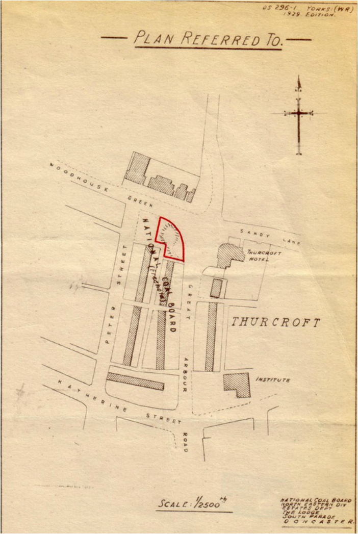
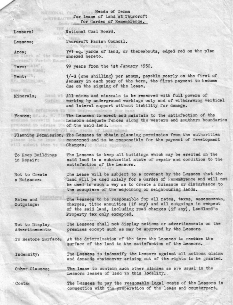
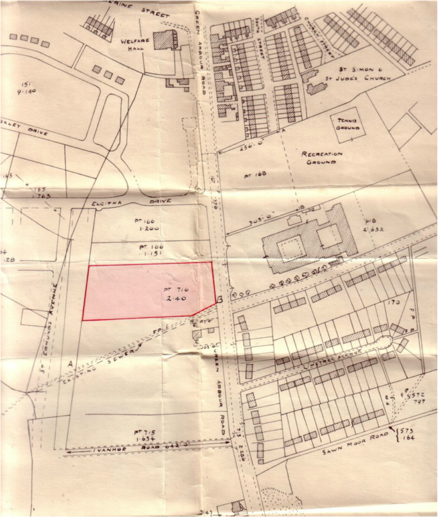
The piece of land selected by the Council is on the plan below, owned by the National Coal Board and was the old Stone Quarry across
from the Thurcroft Hotel. After correspondence between the two party's it was agreed terms and conditions for the site.
from the Thurcroft Hotel. After correspondence between the two party's it was agreed terms and conditions for the site.
The generous terms and conditions are itemised below for the lease of the land.
The plan below shows a piece of land adjacent to Green Arbour Road that now forms part of The Willows School and two Documents
relevant to it's acquisition from 1956.
relevant to it's acquisition from 1956.

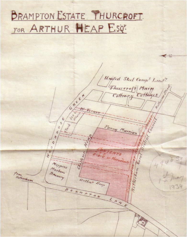
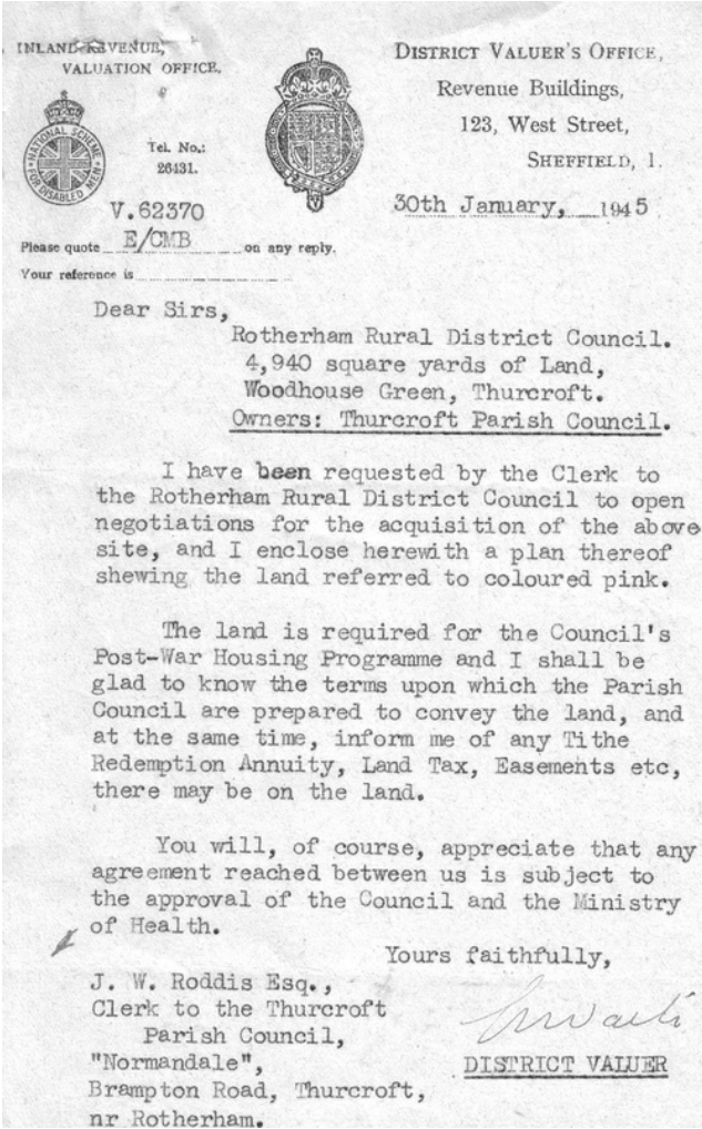
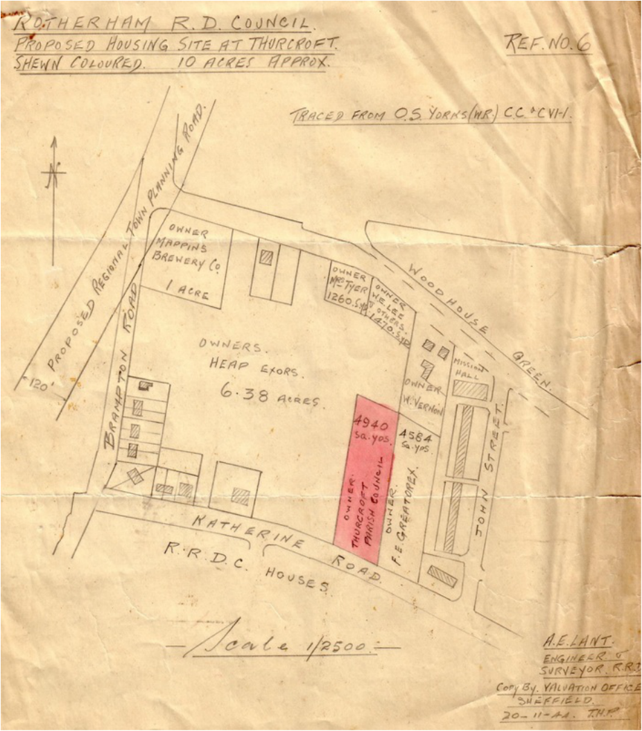
The plan below from 1934 shows an area marked in red that was earmarked for housing in Thurcroft, the area at the top of Katherine Street now houses Rowena Drive. The council needed the area owned by Fanny Marrians that was 4,940 sq yds. The accompanying letter and Plan 2 shows that this problem had not been sorted in 1944/45, and went on much later beyond 1949. It's interesting to note that Mappins Brewery had a 1 Acre plot at the top of Woodhouse Green, and that the United Steel Co are noted with Thurcroft Main Colliery Cottages
The second plan appears to show that a proposed road was in the planning that ran across Brampton Road and Woodhouse Green,
also that the top of Katherine Street was named Katherine Road from Brampton Road down to the bottom of Charles Street.
also that the top of Katherine Street was named Katherine Road from Brampton Road down to the bottom of Charles Street.
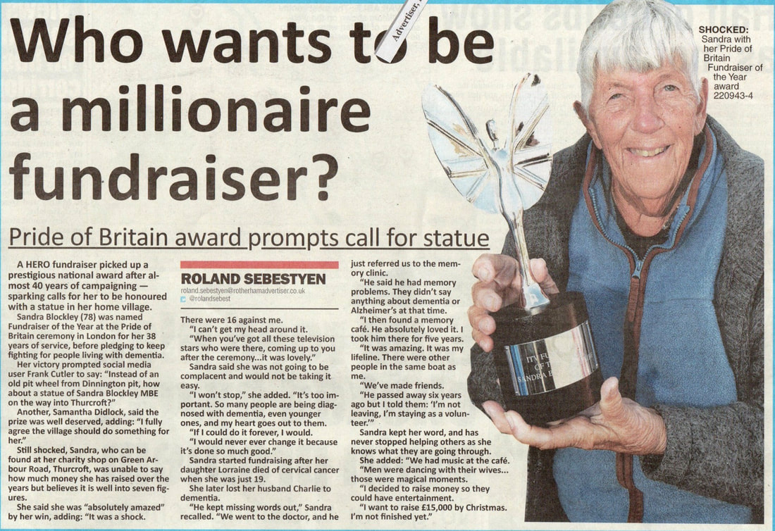
Below is a paper cutting from the Rotherham Advertiser of 3 / 11 / 2022.
Sandra is also mentioned on the time line.
Sandra is also mentioned on the time line.
Down Memory Lane
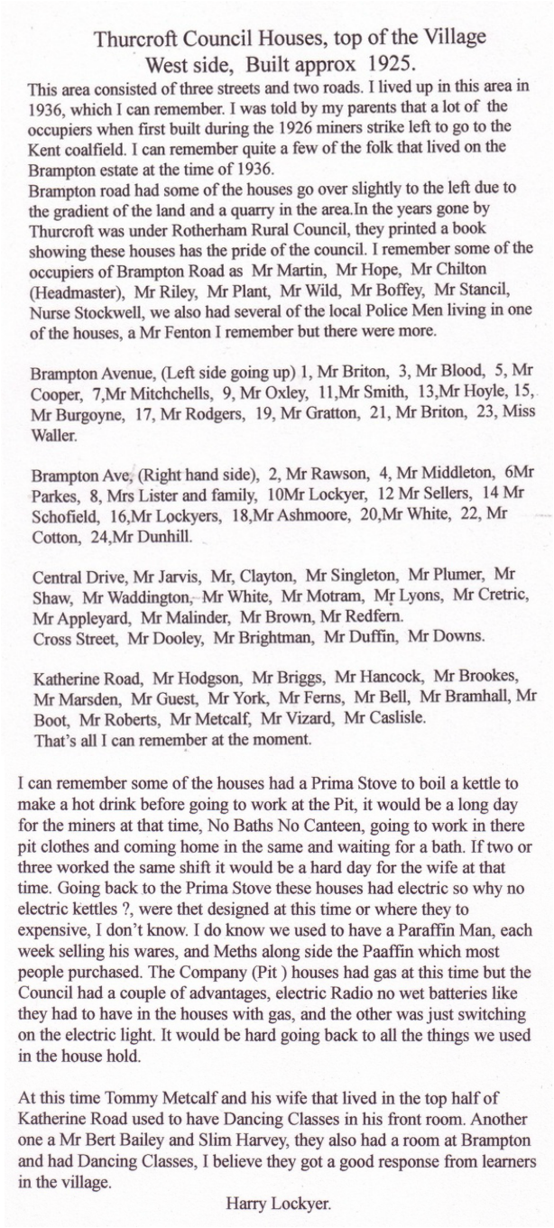
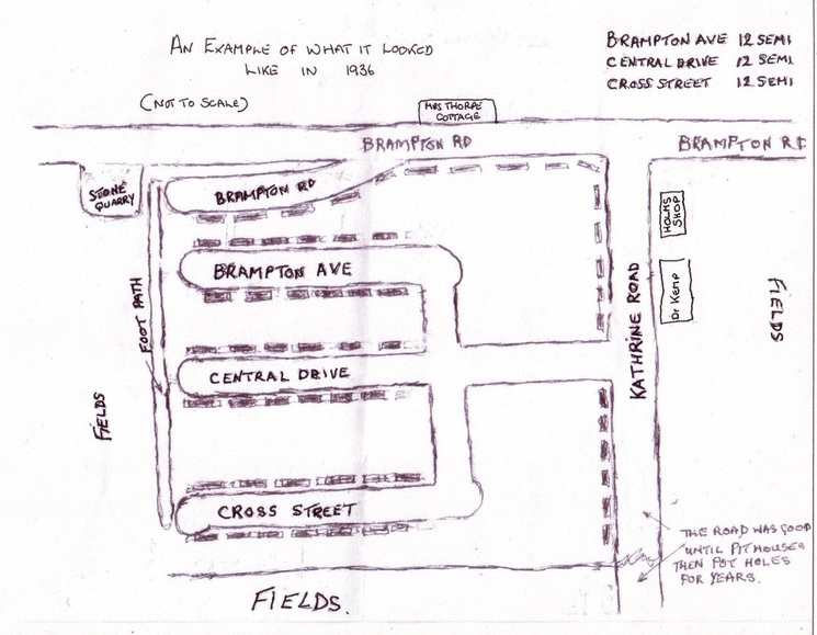
The sketch and information below was very kindly sent in by Mr Harry Lockyer.
The sketch and information below was very kindly sent in by Mr Harry Lockyer.
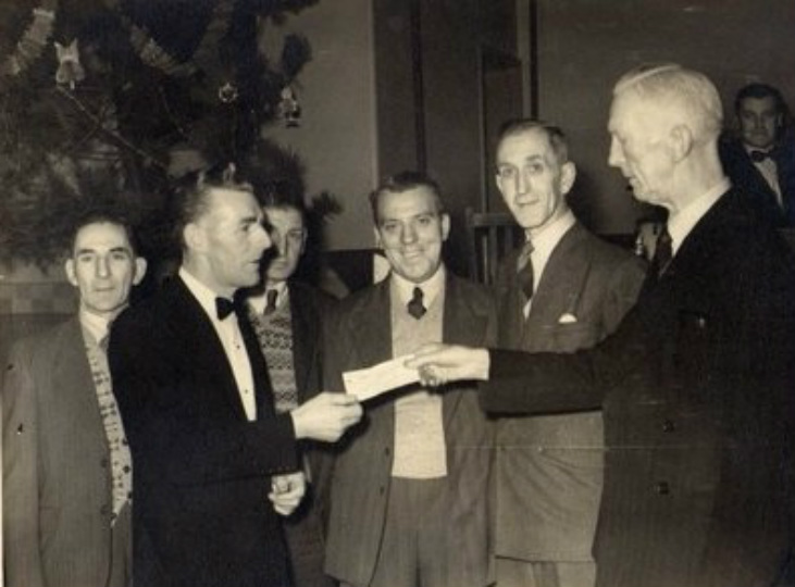
We think this photograph was taken in the Thurcroft Welfare Hall, Christmas time, 1950s. Occasion not known.
The two men holding the cheque are on the right Mr Fred Lees, and on the left Tommy Metcalff.
Others on the photo from the left, Mr Cross, Joe Blackwell, George Downing, Bill Wheeler, chap at the back unknown.
The two men holding the cheque are on the right Mr Fred Lees, and on the left Tommy Metcalff.
Others on the photo from the left, Mr Cross, Joe Blackwell, George Downing, Bill Wheeler, chap at the back unknown.
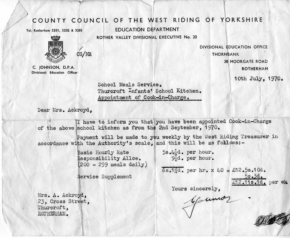
The job appointment letter below was very kindly sent in by Mr Harry Cartledge.
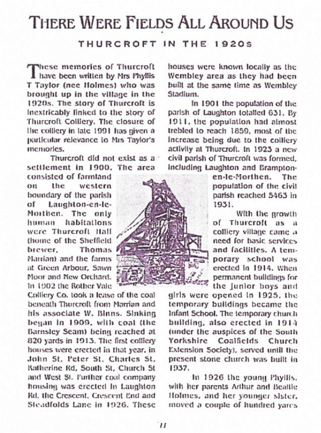
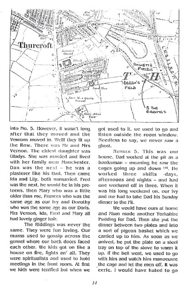
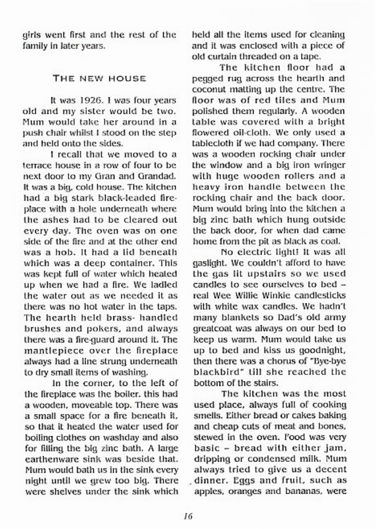
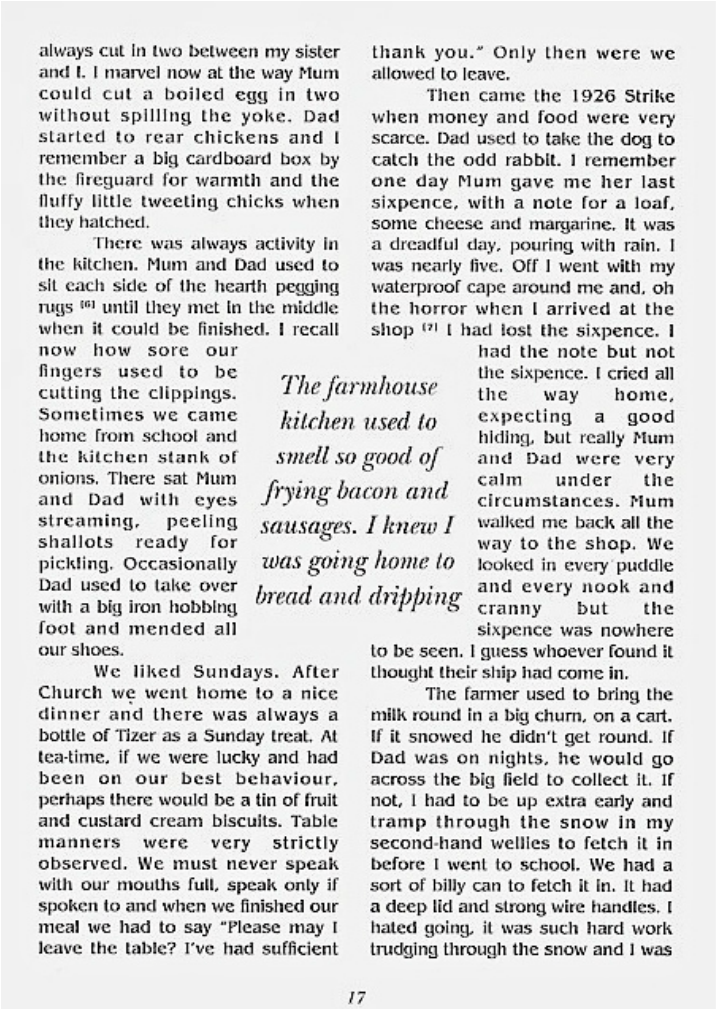
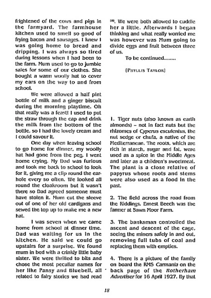
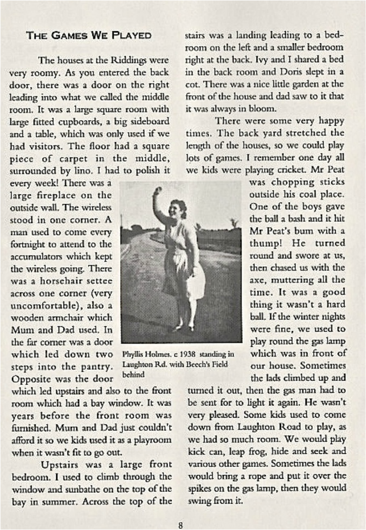
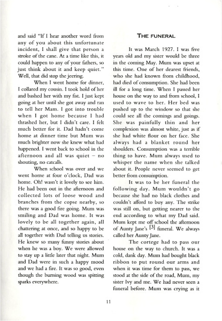
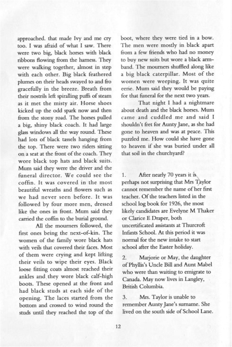
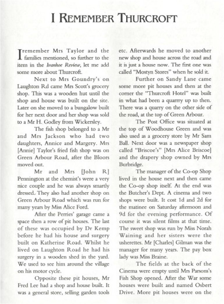
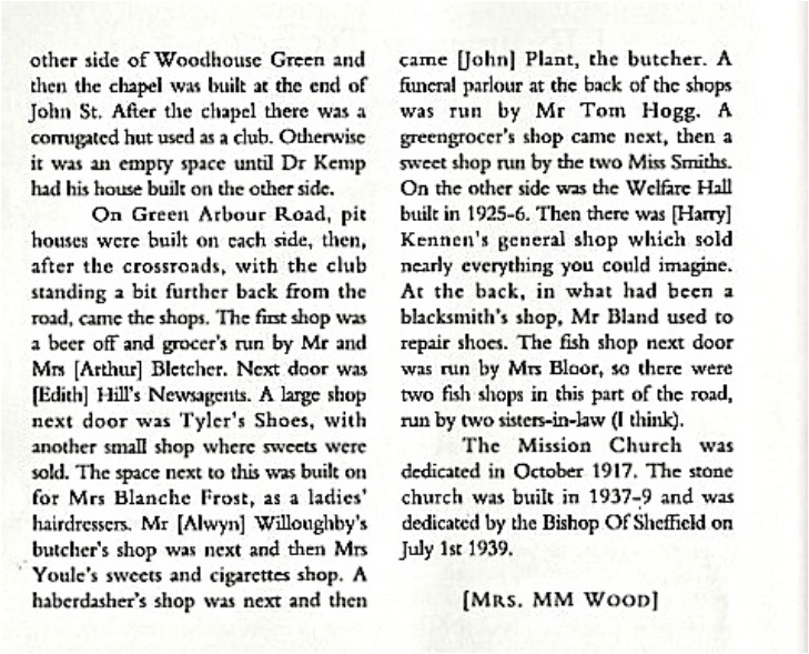
The story below is a wonderful account of life in Thurcroft in the 1920s.
Very kindly sent in to the web site by Paul Jowitt.
From a story in the Ivanhoe Review.
Very kindly sent in to the web site by Paul Jowitt.
From a story in the Ivanhoe Review.
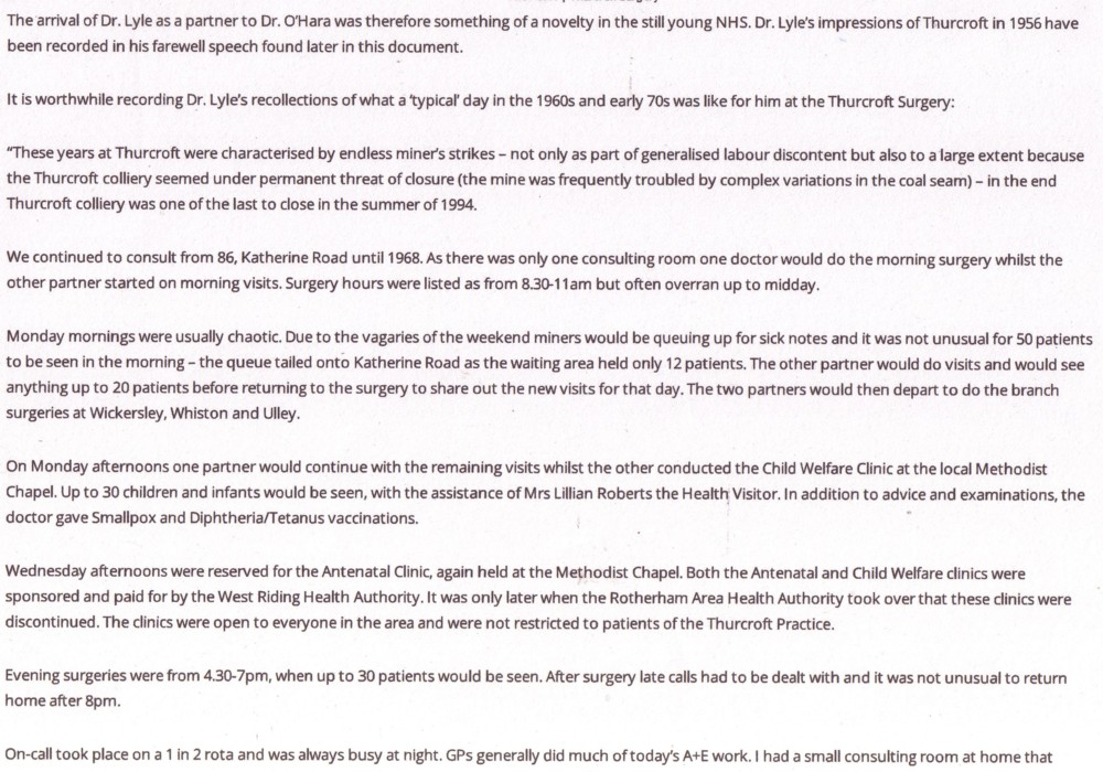
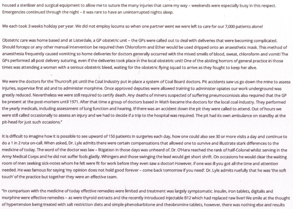
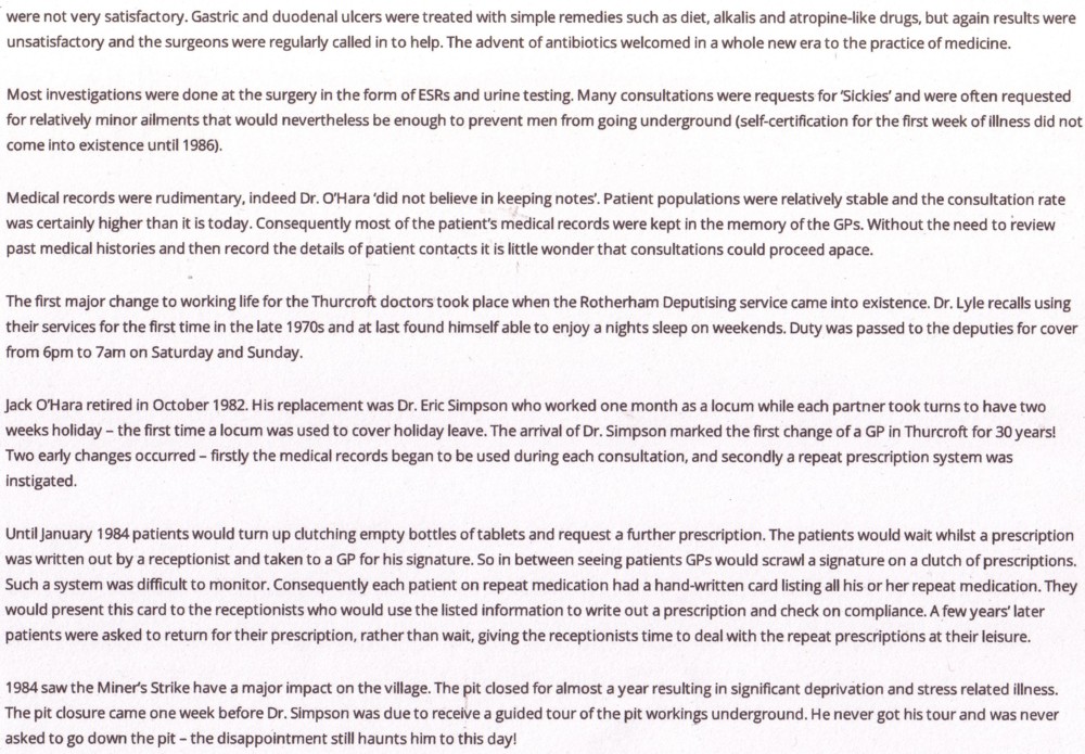
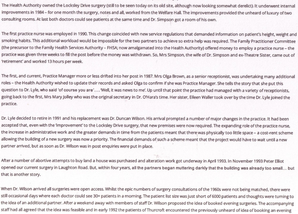
The History of Thurcroft Village Surgery has been copied from the Surgery web site.