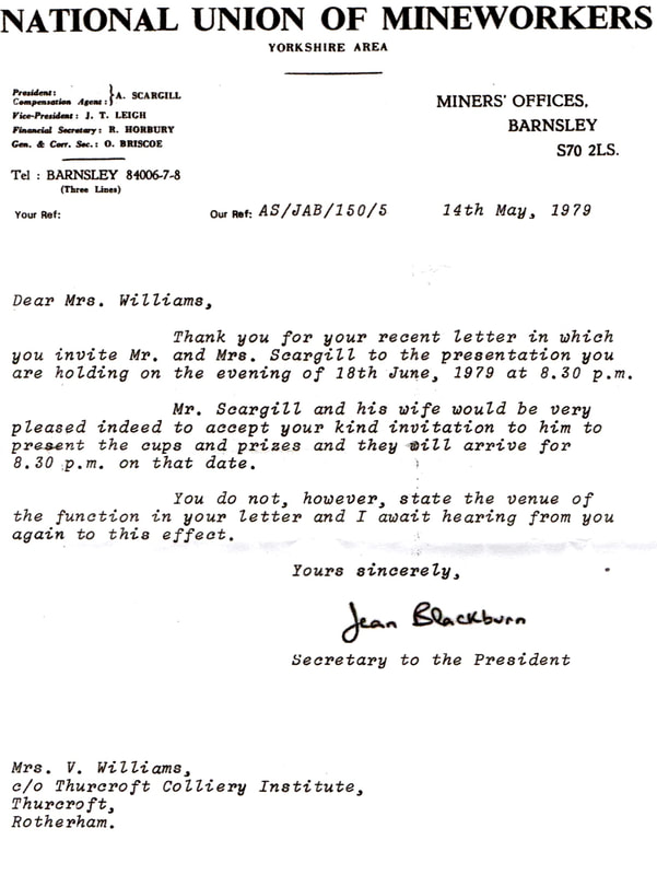
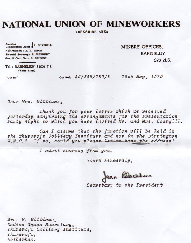
Below are two letters that have been very kindly sent in by Mrs Pauline Hague
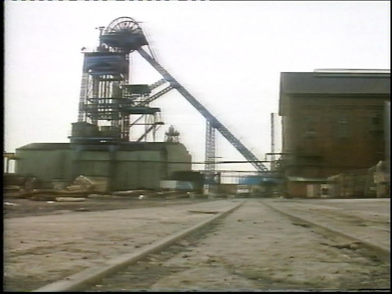
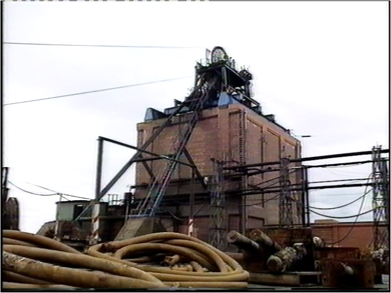
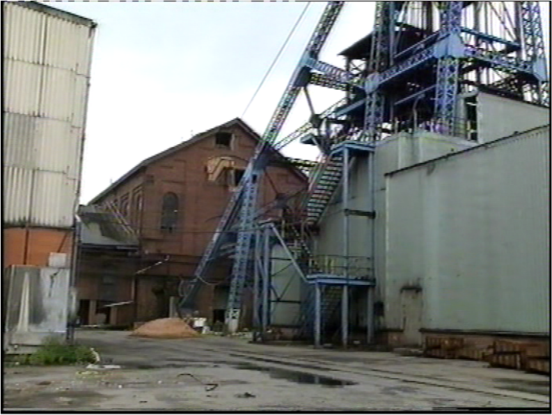
The photo's below of the Pit Top are taken from unusual positions, some of the photo's are from the short film by Mr George Curran and taken just before and during demolition that was started in 1992. I hope you find them interesting, Fred.
From the Rotherham Advertiser 13 / 11/ 2020, of a strike in 1970.
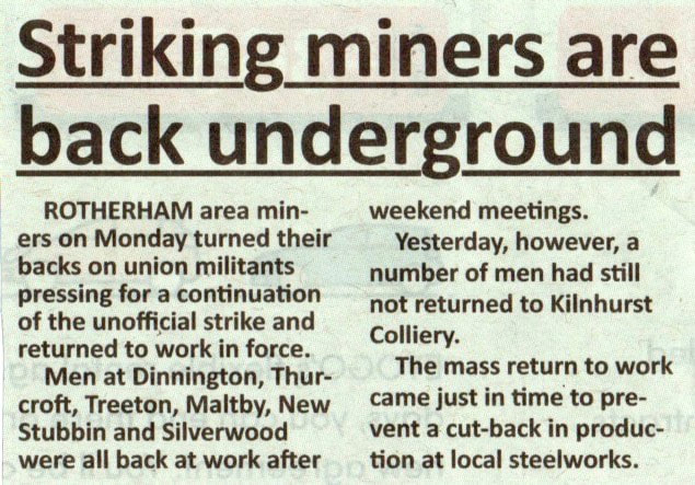
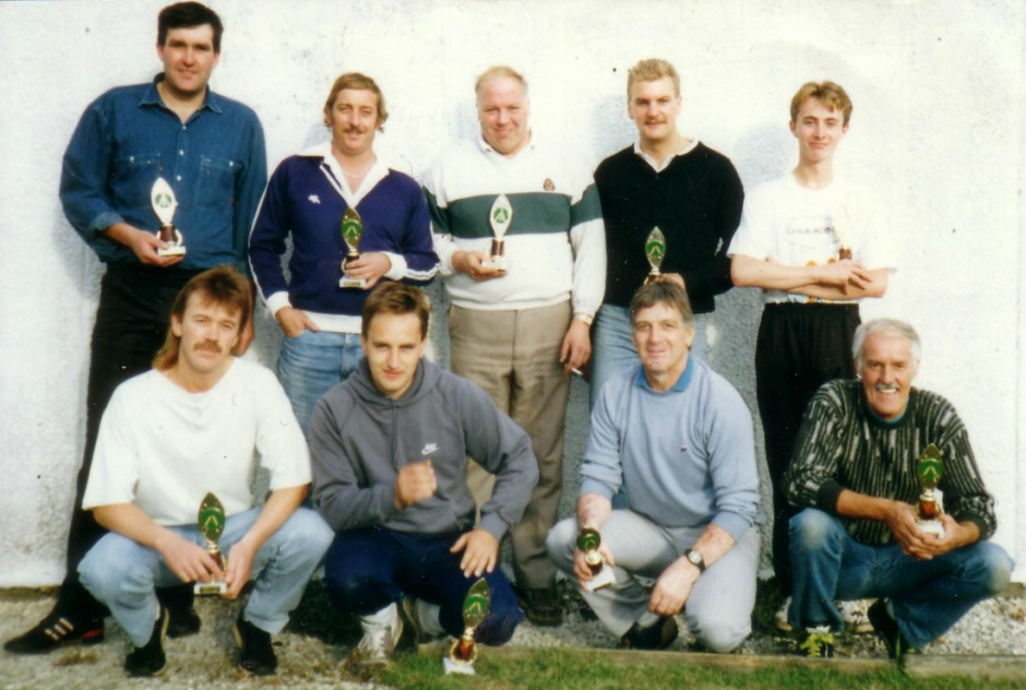
Photo below and Immunisation Card sent in by Alan Page.Photo shows Thurcroft Colliery 7 a side Football team from the 1980s.
Back row L to R. Alan Page. Steve Wynstanley. John Hart. Andy McDonald. Craig Rodgers.
Front. John Warton. Jimmy O'Flahaty. Tommy Sedden. Dennis Ward.
Runners up on this occasion.
Back row L to R. Alan Page. Steve Wynstanley. John Hart. Andy McDonald. Craig Rodgers.
Front. John Warton. Jimmy O'Flahaty. Tommy Sedden. Dennis Ward.
Runners up on this occasion.
The photo below was very kindly sent in by Mr and Mrs Alan Tomlinson, it shows the wedding day photograph of the newly weds Mr Albert Tomlinson and his bride Mary, walking up to there house on Sandy Lane in 1930 with well wishers at the bottom of the garden. In the background can be seen the Pit, the white square above the brides head is the end board on the Cricket field as it was then.
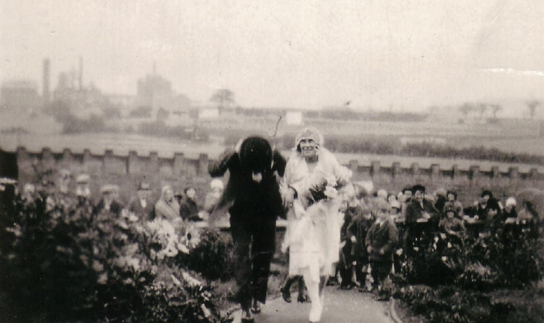
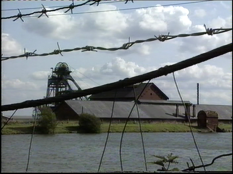
Photo sent in by David Page, showing the Reservoir in winter Frozen Over before it was drained. with part of the Washer in the background.
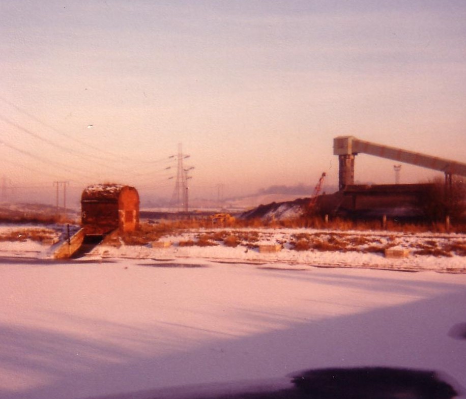
Photo below taken outside the Pit Head Baths in late 1970s / early1980s. L to R. Richard Brown (First Aid attendant). Mrs Doolan, & Mrs Bubb, (Office Cleaners). Ron (chippy) Johnson,Afternoon shift Overman).
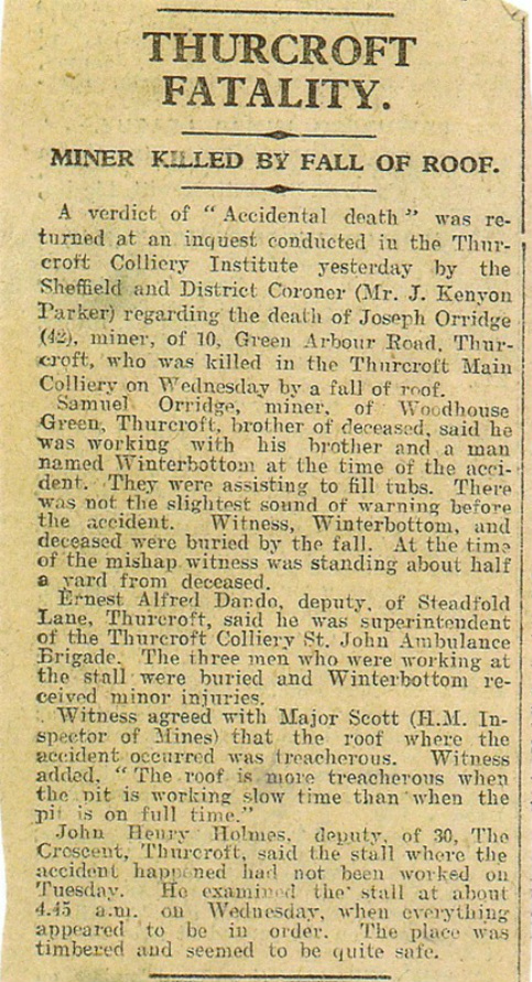
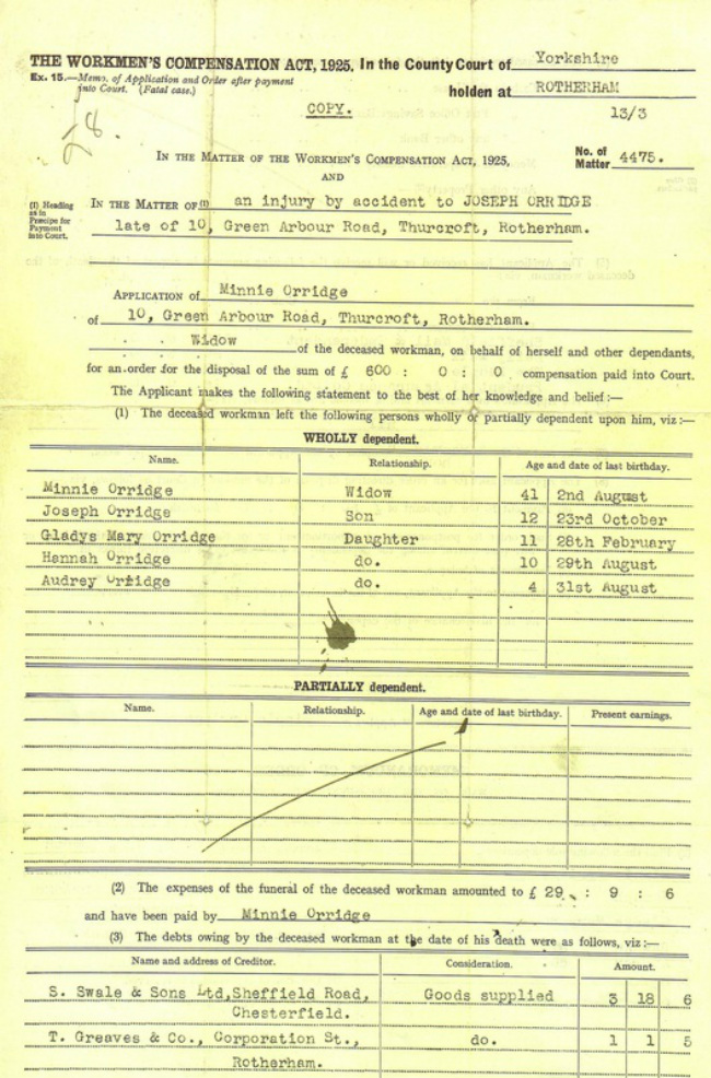
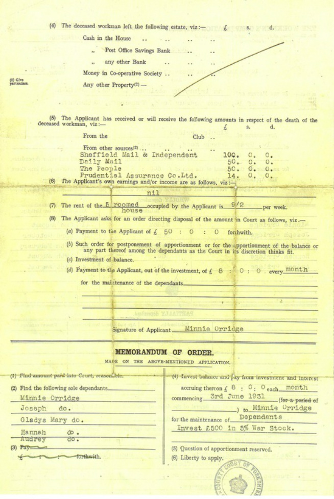
The news paper clipping and Compensation form below were very kindly sent in by Steve Smith, they both refer to Steve's Great Grandfather, Mr Joe Orridge Snr who was killed at Thurcroft Pit in March 1931.
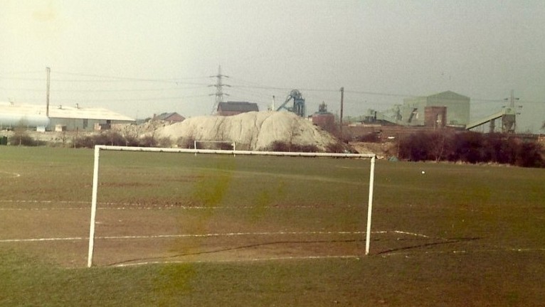
Below is a view of the Pit Top and the football pitch from the back lane sent in by Andy Cartledge. The large mound behind the pitch is clay from when the Brick works were in operation. The vehicles from the brick works used to go across the back lane to get to the Quarry.
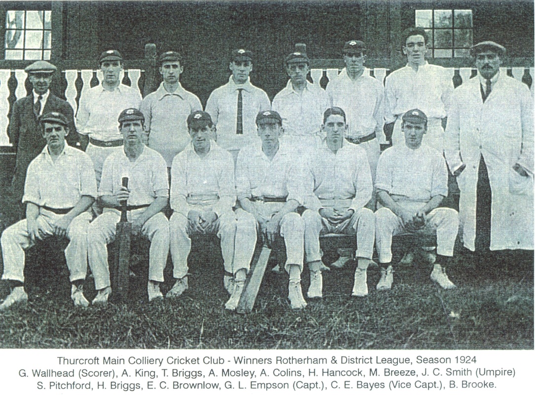
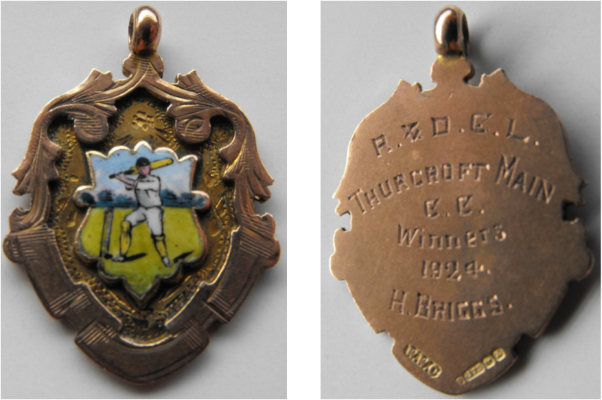
Photograph below was very kindly sent in by Derek Oxtoby it shows the Thurcroft Main Colliery Cricket Club winners of the 1924
Rotherham & District League. Second photo is one of the winners medal, this one belonging to Mr H Briggs, second from left ( seated )
Rotherham & District League. Second photo is one of the winners medal, this one belonging to Mr H Briggs, second from left ( seated )
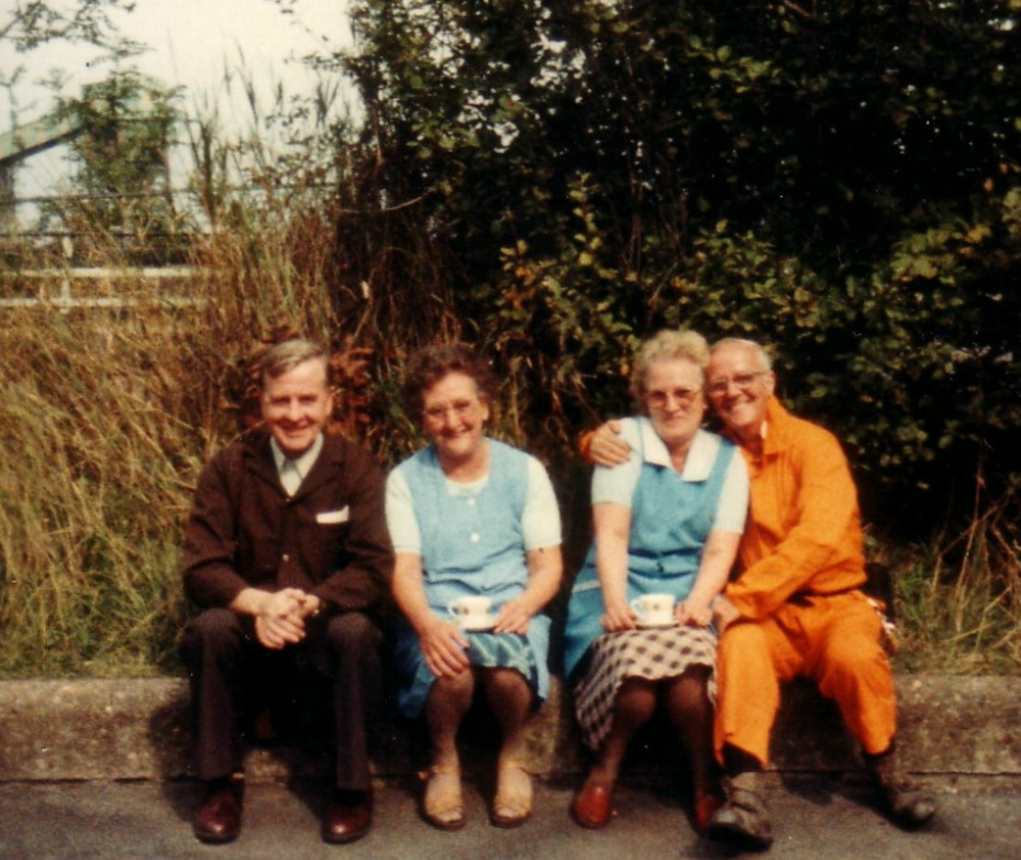
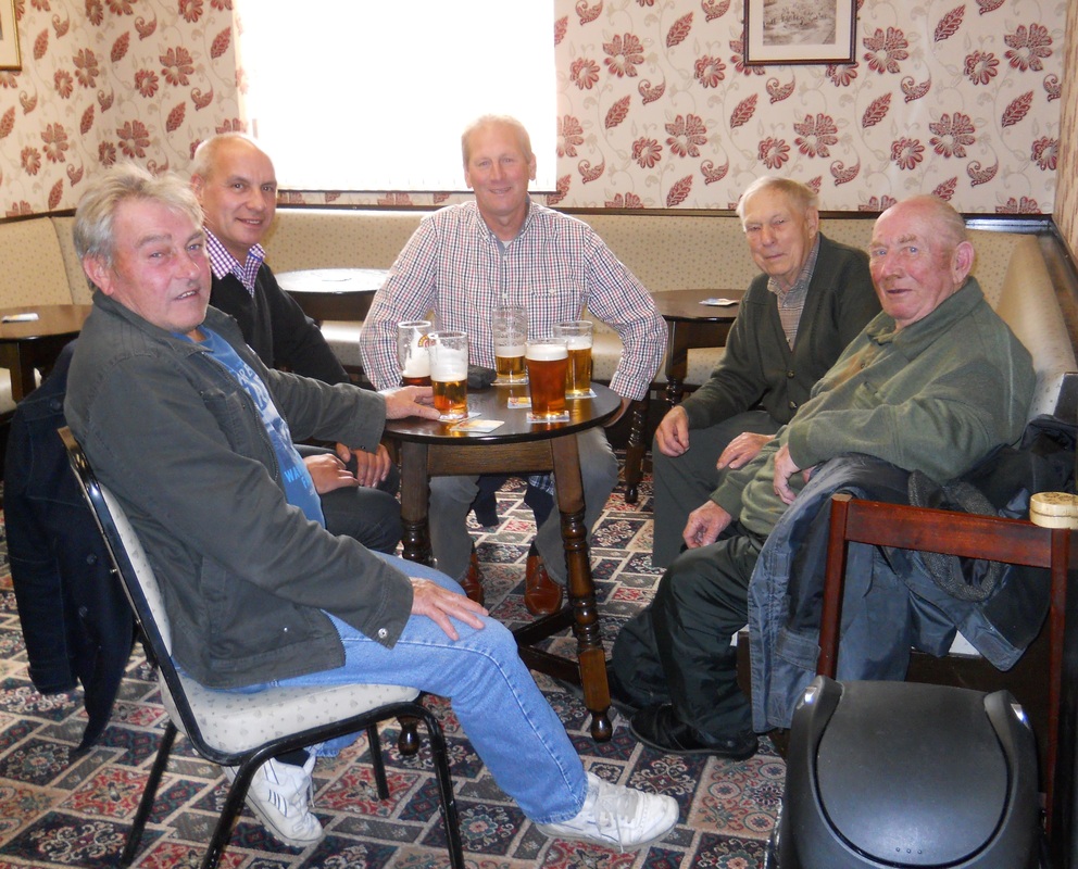
The photograph below was very kindly sent in by David Page, it shows a group of old workmates having a drink together in the Bottom Club.
L to R, Pete Bower. Martin Booth. David Page. Les Barrett. Dennis Hollins.
L to R, Pete Bower. Martin Booth. David Page. Les Barrett. Dennis Hollins.
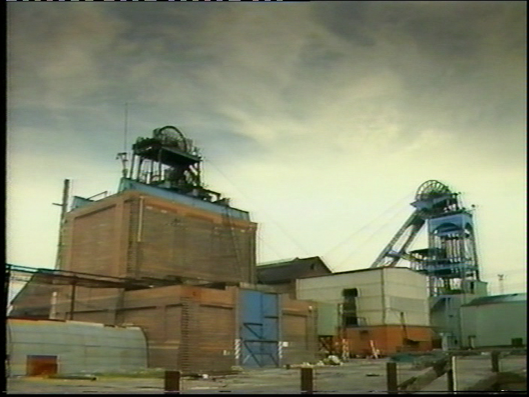
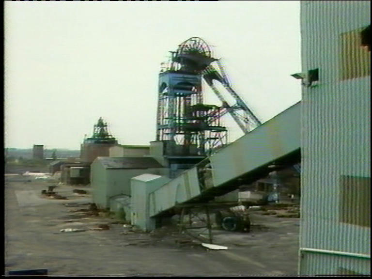
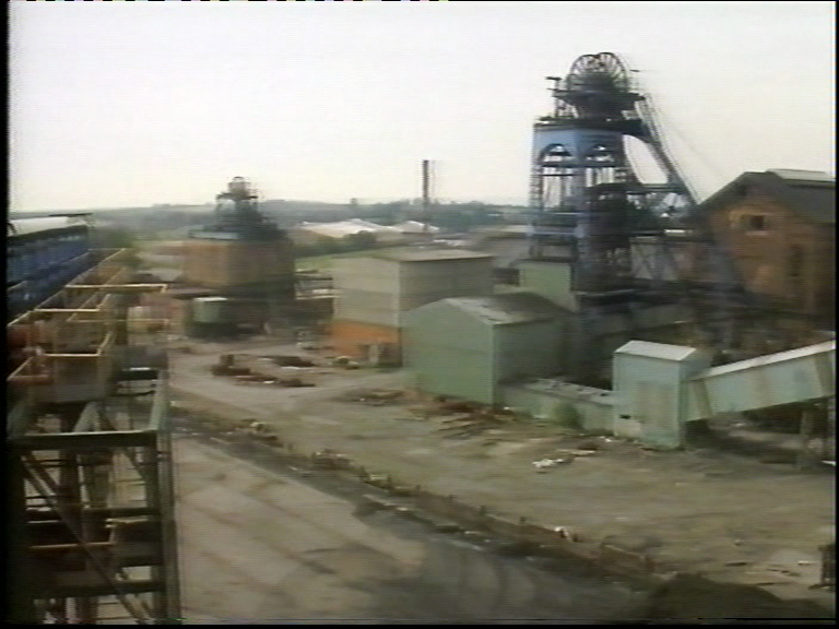
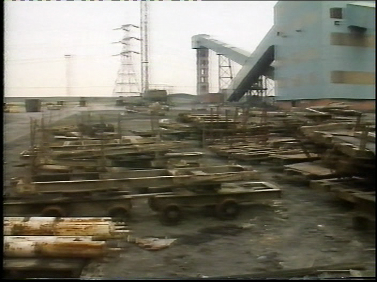
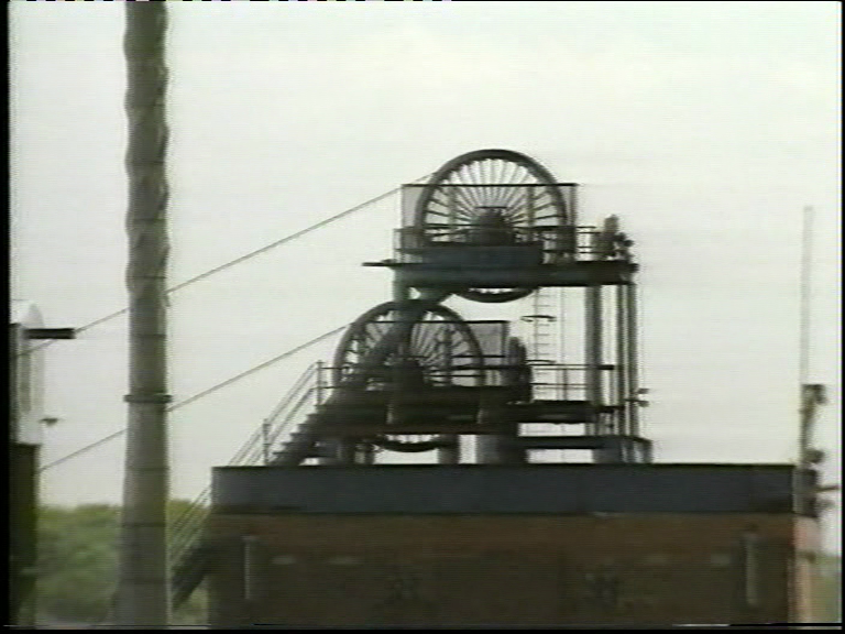
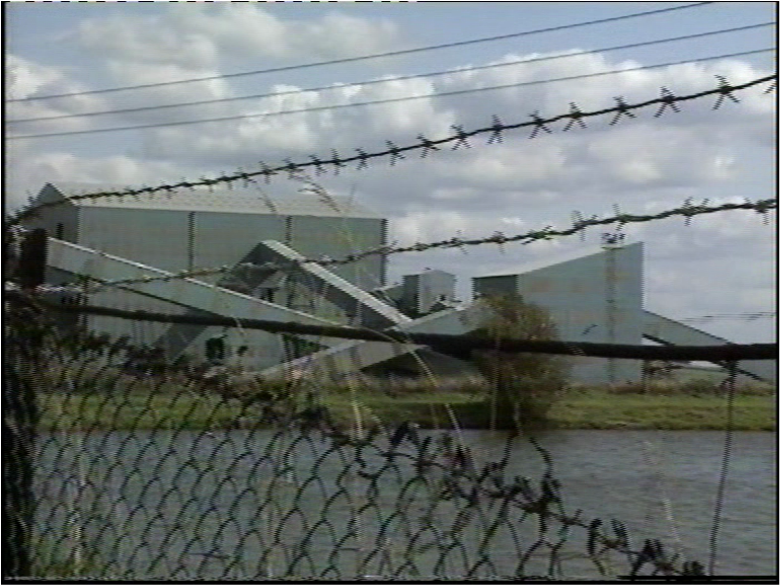
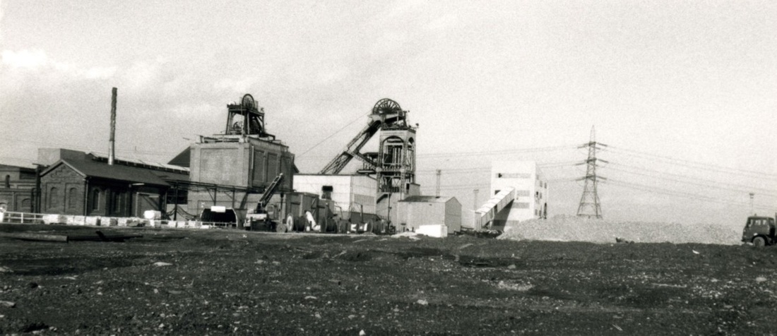
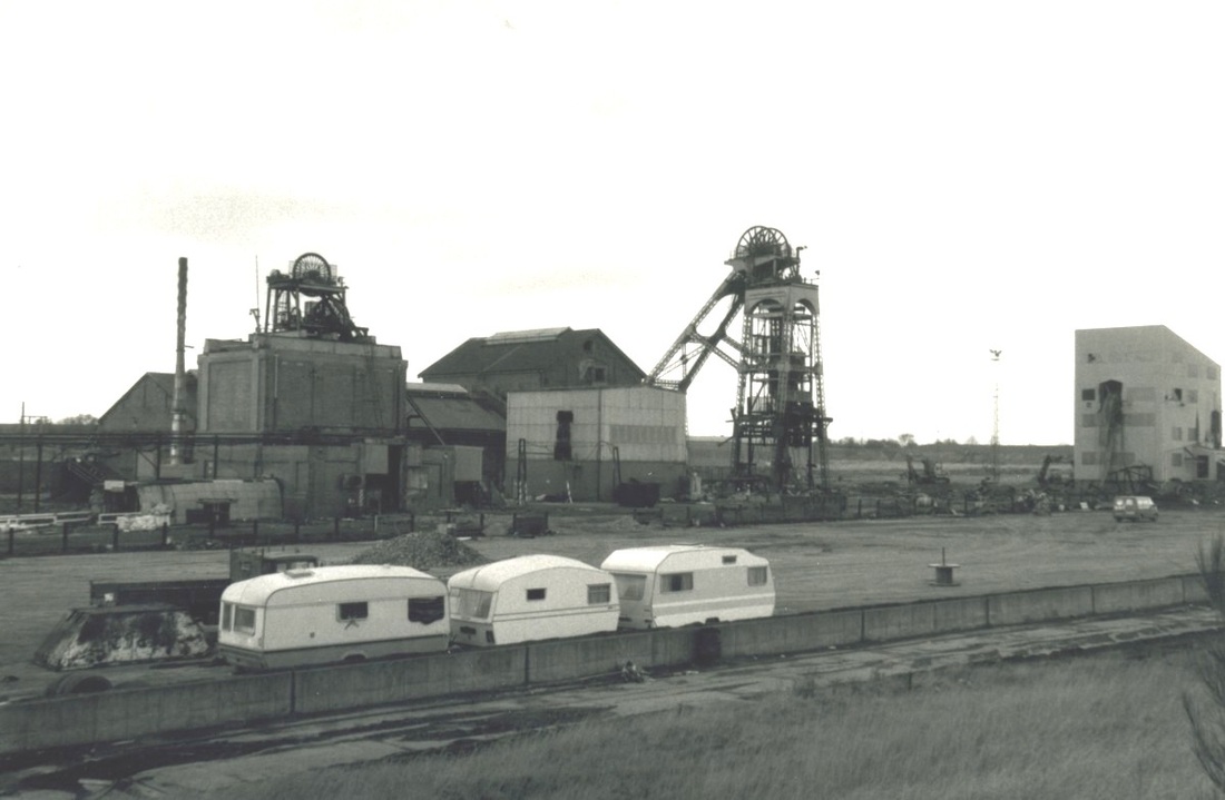
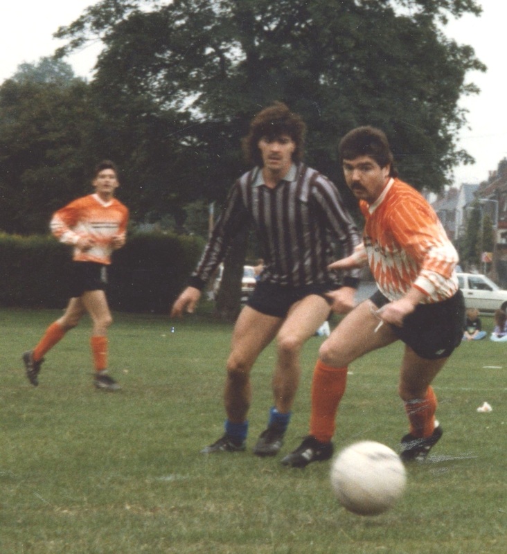
The three photo's below were very kindly sent in by David Parry, first two show Pit Top. First one approx June/July 1992.
The surface features are almost as were left on Pit closure except for the large pile of hardcore waiting to be used to fill the shafts.
The surface features are almost as were left on Pit closure except for the large pile of hardcore waiting to be used to fill the shafts.
Second one shows demolition in progress, winding ropes gone, structure round Downcast Headgear gone, and part of stacker dismantled. Contractors caravans can be seen in the foreground.
Third one is of a Football Match at the Miners Demonstration, front is Ziggy Scott, then John Wharton, at the back is Martin Wheatley.
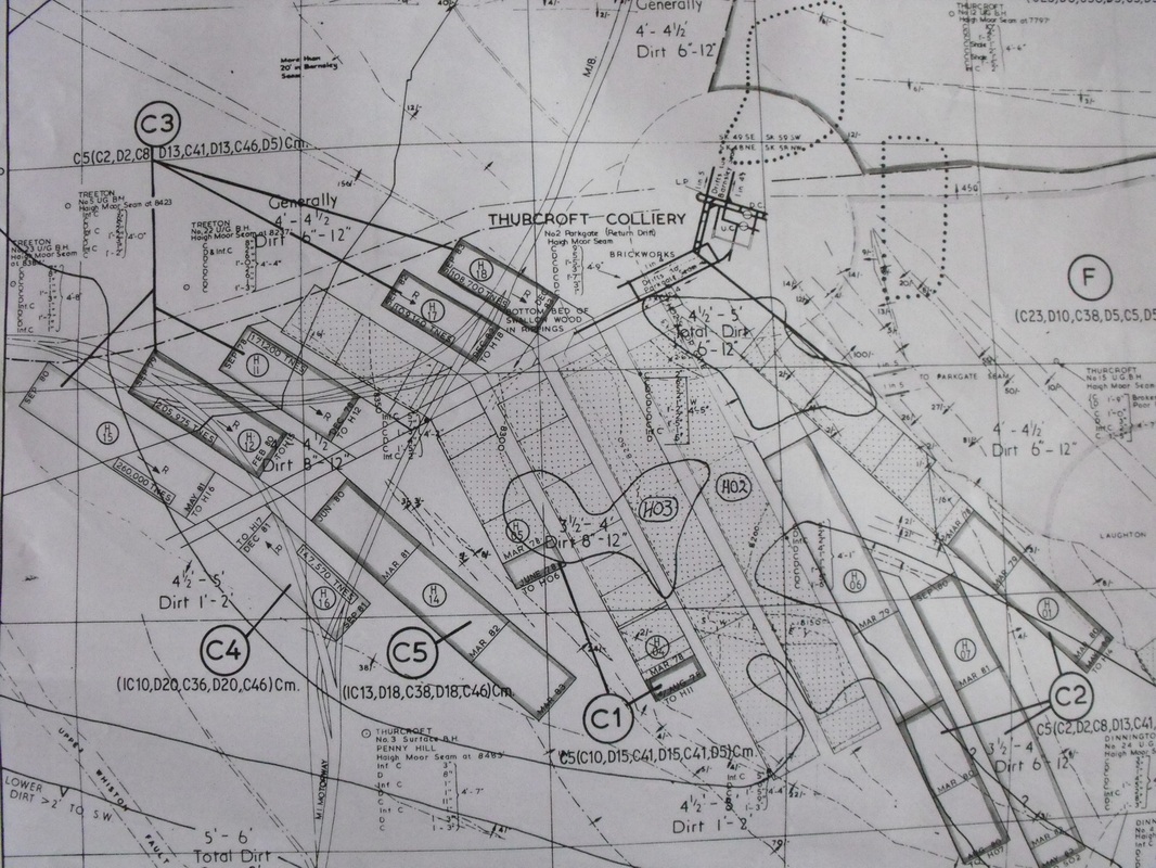
The two plans of Thurcroft Haigh Moor and Swallowood seams were very kindly sent in by Sean Burke. First one is the Haigh Moor Seam. It shows the reserves in that seam in 1978, all the faces are numbered and most viewers who worked this seam will recognise the plan. Some of the surface and underground bore holes are just about readable.Treeton is just off the top left, Dinnington just off bottom right.The lines of figures in brackets are the seams in sections, C= Coal, D= Dirt, and are in Centimetres (2.5 centimetre = 1inch) the other measures are in feet and inch's. The M1 Motorway can be seen on plan from bottom left it swings round towards the left (West) above H12s. The M1 connecting roads to the M18 can be seen going north above ( H17 & H18) Bramly junction 1 M18 is just off top of plan The circle right hand side around the word Laughton is the area of coal pillar left under Laughton church,to protect it from subsidence.
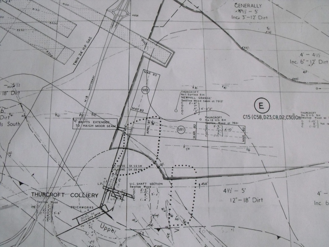
Second Plan is swallowood, again it shows reserves in 1978. The large area inside the thick black line is reserve for Thurcroft.
There is another area of reserves off the bottom of the plan. The Workings coming in from top left are coal face workings from Silverwood Pit.Once again the numbers in brackets are in (centimetres) other measurements in Feet and Inch's. The M18 junction 1 can be seen top of plan The circular area around the shafts is the shaft pillar, left to protect the shafts from any ground movements.
There is another area of reserves off the bottom of the plan. The Workings coming in from top left are coal face workings from Silverwood Pit.Once again the numbers in brackets are in (centimetres) other measurements in Feet and Inch's. The M18 junction 1 can be seen top of plan The circular area around the shafts is the shaft pillar, left to protect the shafts from any ground movements.
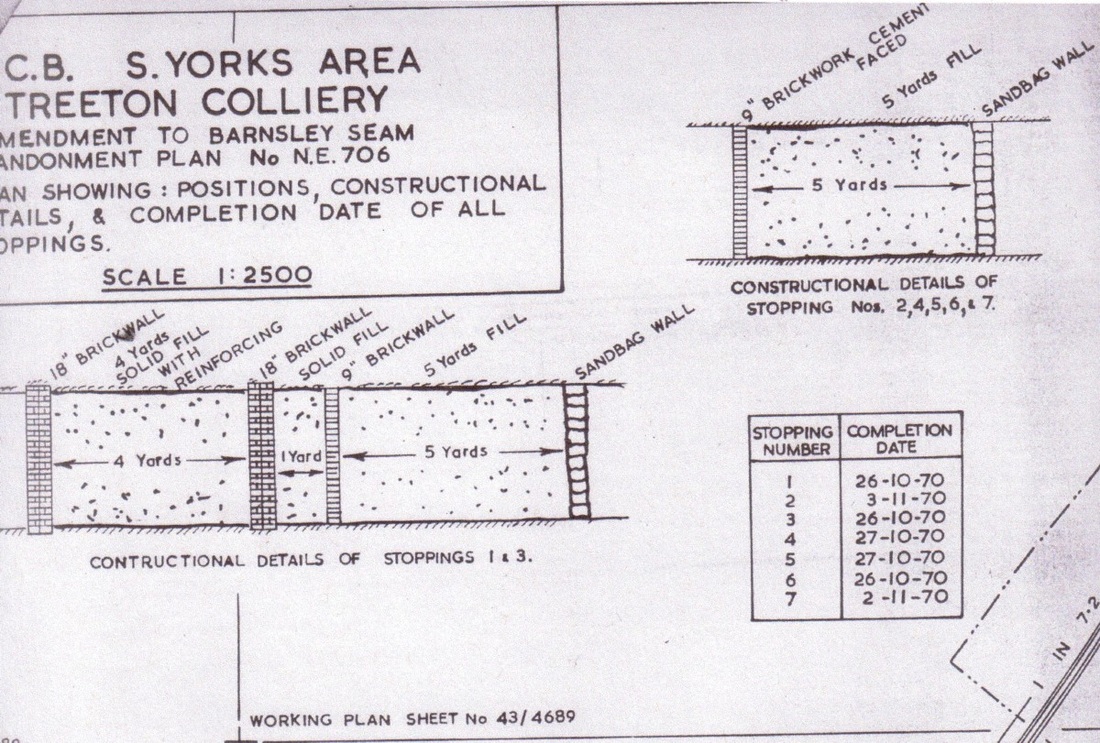
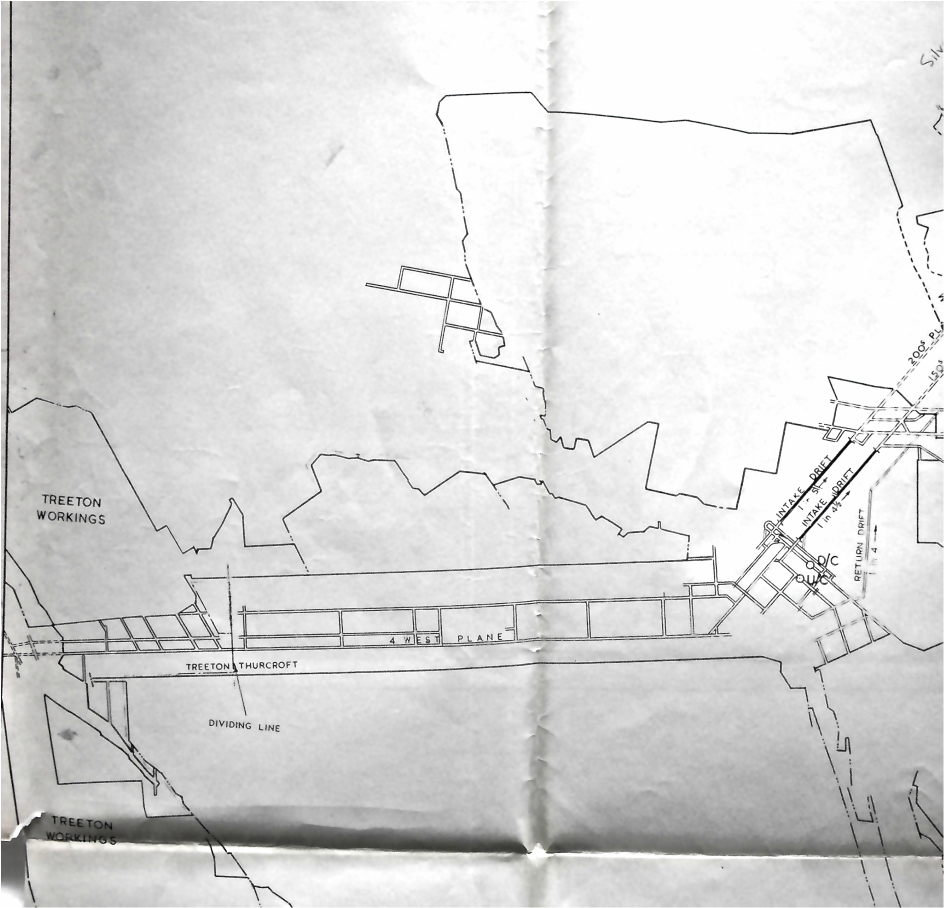
Last one from Shaun shows a diagram of the stoppings between Thurcroft and Treeton in the Barnsley seam.
Information below very kindly sent in by Mr Harry Lockyer.
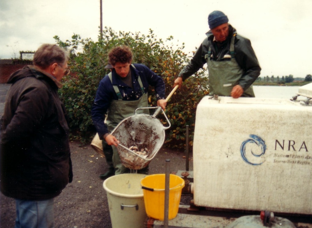
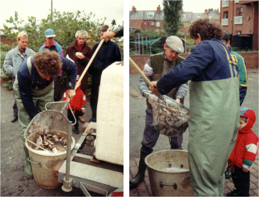
The three photographs below were very kindly sent in by Mr Brian and Mrs Irene Shaw. They show the fish rescued from Thurcroft
reservoir being taken to Sandhills at Worksop. Some of the fish were also sent to Harthill Ponds. Thurcroft fishing club members accompanied the transport of the fish.
reservoir being taken to Sandhills at Worksop. Some of the fish were also sent to Harthill Ponds. Thurcroft fishing club members accompanied the transport of the fish.
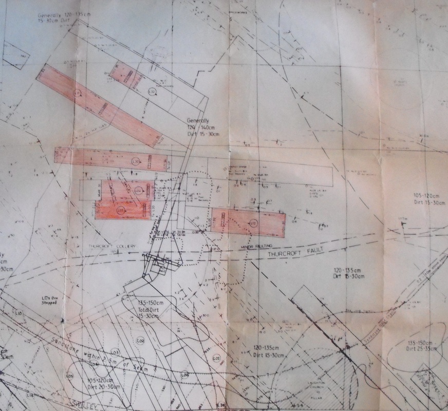
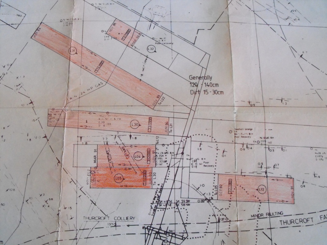
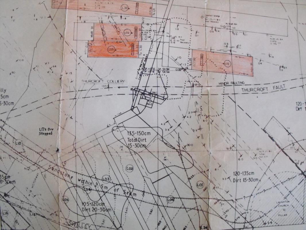
The 5 Year Plan of the Haigh Moor Seam below was very kindly sent in by Ken Tomlinson via Harry Cartledge. The date on the plan is
June 1991, so the face's you see marked in red are to be opened and worked until 1996. As can be seen the map is a bit to large to put on the site in one go so the first photo is most of the plan, second photo is a close up of the face's, and the last one shows a close up of the old Haigh Moor area in relation to the new developments.
June 1991, so the face's you see marked in red are to be opened and worked until 1996. As can be seen the map is a bit to large to put on the site in one go so the first photo is most of the plan, second photo is a close up of the face's, and the last one shows a close up of the old Haigh Moor area in relation to the new developments.
Below shows new development face's and dates they were planed to work. Junction 1 of the M18 (Bramley) just to the north of L 32s face.
Below, old Haigh Moor area to the south of the Thurcroft Fault. New face's to the north of the fault.
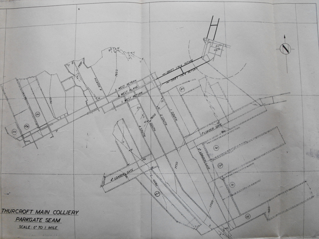
Below, Thurcroft Park Gate and Barnsley seams up to approx 1963. Thanks to Helen Simpson.
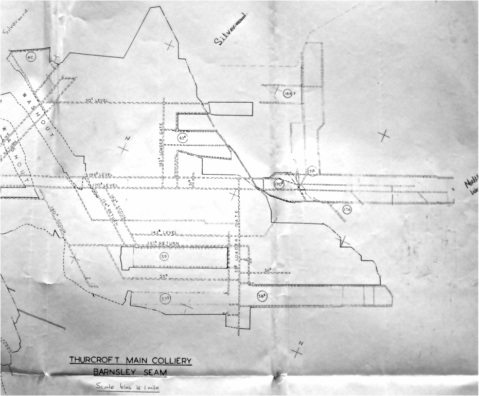
Below, Barnsley Seam, up to 1963, to large to put on in one piece. Bottom half should fit to the left of the top half.
The four photo's below were very kindly sent in by Terry Abbott, first on shows a summers day at harvest time, with the pit in the background.
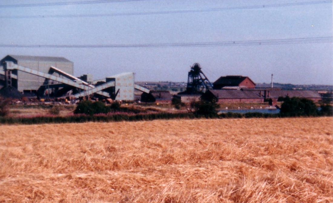
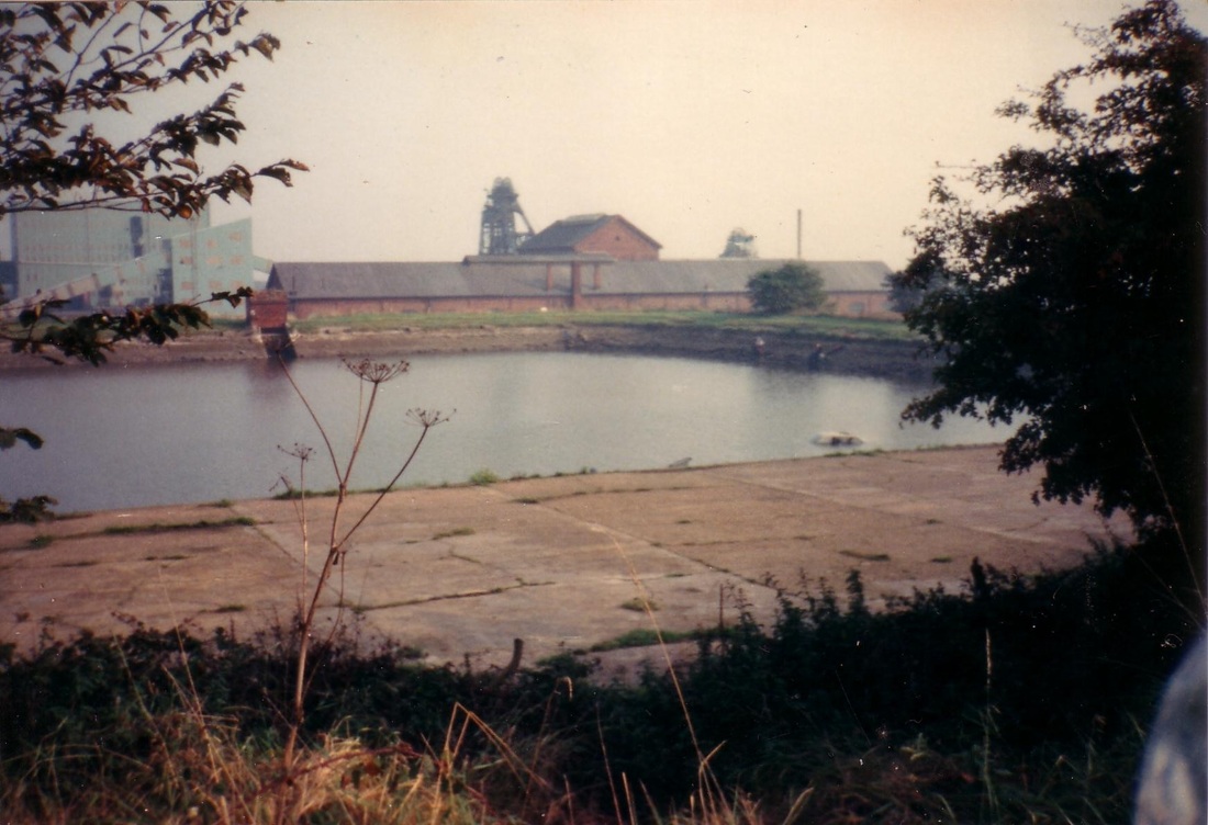
Photo below of Reservoir with a couple of fishermen before the reservoir was empted.
Next photo is of the near complete demolition of the Coal Prep Plant.
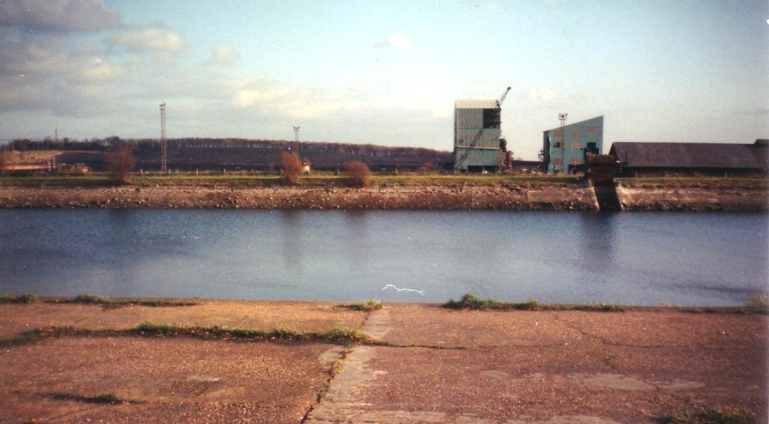
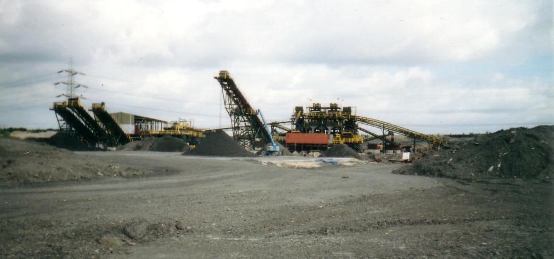
Photo below shows the plant that was erected on the pit tip to reclaim the coal and make ready for a Domestic waste tip.
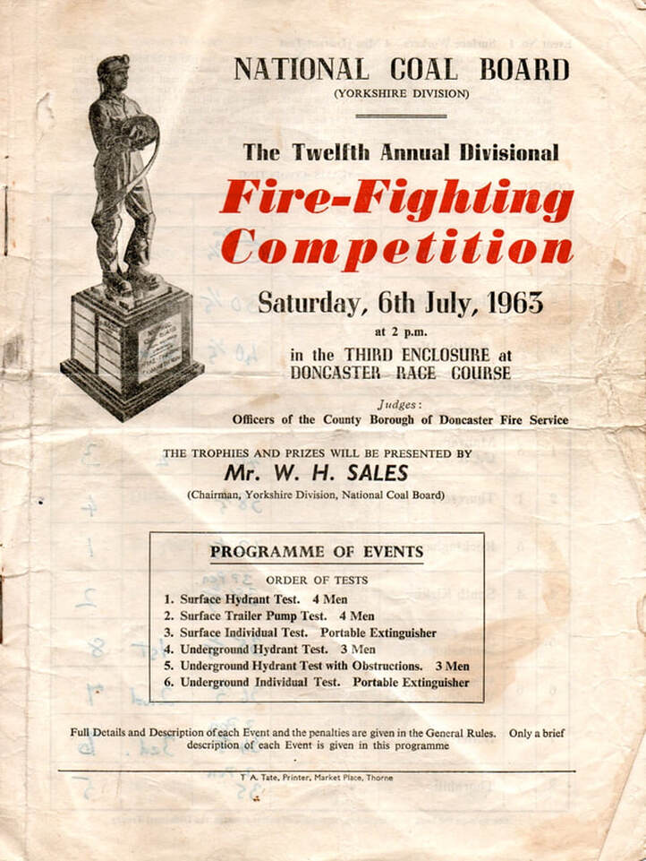
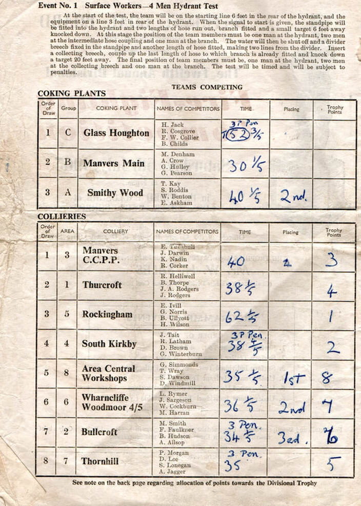
The Fire Fighting paphlet below was very kindley sent in by Mr Harry Lockyer.